Geography
Topography development
Our former ideas of landscape development were considerably modified by quarterological studies carried out in this area in the past few years. The following conclusions could have been drawn from the results of pollen- and geochemical analysis of the deep boring into the Halas-fenék marsh in Zám-puszta in the southern part of the Hortobágy.
Presumably this marsh got separated from the former, ca. 40,000 years old main river-bed of the Sajó. The ox-bow lake became a cold, oligo-mesotrophic lake with carbonate-free sedimentation which preserved pollen: primarily the arboraceous pollen of Scot's pine, secondarily that of birch (Betula sp.) and willow (Salix sp.) species. However the proportion of non-arboraceous pollen has started to increase, mostly that of wormwoods (Artemisia sp.) and grasses (Graminea sp.) at the expense of the arboraceous pollen. This lake dried out about 20-30 thousand years ago that is testified by a thin layer containing precipitated amorphous limonite, from which time no trace of pollen is to be found, since the remnants of them disappeared during dry periods.
While about 4 m of sediment was deposited in the former period, it amounts only 20 cm in the layer containing limonite. After that a periodic process started: layers less than 1 m deep alternate with layers containing limonite similar to the above-mentioned layers indicating dry periods. The thicker layers formed during periods when this area was a cold, mesotrophic lake with sediments rich in carbonate. Thus strong erosional processes must be working in the immediate catchment area of the lake since there is no calcium accumulation in cold-water lakes. The pH of the lake was increased by sediments rich in calcium and dissolved the sodium content of the parts of sediment containing silicate. The alkalization process has probably started in many places of the Hortobágy at this time, but this area was certainly one of them. The sedimentation process of the lake was interrupted four times by desiccation indicated by the presence of layers containing limonite, during which periods alkaline areas were continously present. This indicates a severe climate: the desiccation in spite of the very cold climate could have happened only in case of very low annual precipitation. Alkaline lakes in similar (or even colder) climate can be found in the zone of perpetual frost in Siberia in the southernmost part of Yakutia. The water of these lakes is very cold and still alkaline. Their bed is formed by the collapsing of the permafrost. After the last desiccation of the Halas-fenék marsh not sediments typical for cold lakes were form but eutrophic marsh sediments in a layer of abut 70 cm: now we are in the Holocene, the water is warmed up and its production of organic material increased. The upper, 50 cm deep layer of clay transformed into soil constituting solonetz meadow soil.
What do these observations indicate? The separated river-bed of the Sajó received water supply for a long time from the main river that was close but got farther and farther. A stabile, 4 meters deep lacustrine, carbonate-free sediment layer formed above alluvial layers in good water supply conditions. The lake could have been surrounded by galery forests (a mixture of Scot's pine-White birch and several willow species). These forests became more open while the lake got farther from the river with the proportion of the pollen of the cold steppe in the surroundig area getting higher in the sediment. The stabile water supply was geologically disturbed 20-30 thousand years ago that made the depression dry out. The Tisza presumably appeared in the Tisza-dike at this time cutting through the traditional waterways coming from the Northern Mountain Range (Északi-Középhegység). The ancient Halas-fenék could have been filled up with water only much more rhapsodically by the floods of the Tisza than its former water supply system.
The catchment area of the water body becoming quite narrow was covered by large quantities of lowland loess soil at this time (insufficient draining), that was mostly the result of erosion and not that of the filling-up process of the Tisza. Accordingly considerable amounts of sediments rich in calcium got into the river-bed forming it into a cold, alkaline lake by its alkalizing effects (mobilizing Na-forms). Durable desiccations (that seems to occur in periods of 3-5 thousand years) may have caused by either the tectonic cuttings of waterways or small, periodical changes in the climate. Amorphous limonite separated at such times. (Short desiccations of annual periods could have been regular in other cases as well.)
The Tisza was no longer able to deposit large amounts of sediments in this area. Its shallow floods does not reach this region every year and contained only smaller quantities of floating deposit (the whole set of deposit layers not transforming into soil is altogether 70 cm deep). Probably the infusional loess was not carried by rivers in the upper Pleistocene into the catchment area but it was deposited as falling dust; besides the eolic deposits were made hydromorph by the rare shallow floods (the watertable is not deep enough for the regular forming of inland waters.
It was an important statement of geological studies carried out afresh that the base of deposits of the river-bed of the Tisza is fine-grained sand rich in muscovite mica in the Közép-Tisza region. On the contrary one can find rough-grained sand or gravelled sand on similar topography so these beds cannot be those of the Tisza. The same processes were discovered when analysing the valleys of the Kengyel-ér and Hódos-ér marshes near Polgár or the Paperi marsh in the Hortobágy in a similar way that was carried out in the case of the Halas-fenék marsh: lacustrine sediments poor in carbonates in the lower parts and paludal, 1 m deep sediment layer rich in organic material from the Holocene in the upper parts. The separations of deposit segments containing limonite and carbonate indicate the regular lowering the water level or even desiccation. The younger yazoo-beds alongside the Tisza near Polgár are everywhere rich in organic material. Regarding the detailed pollen analysis of sediments from the late Pleistocene or early Holocene, pollen samples indicating the least amount of forests in Europe were discovered in the Hortobágy! Similar samples are known from the northern foreground of the Caucasus (Kuban Lowland). The proportion of arboraceous pollen was rarely as high as 50% in the marshes of the Hortobágy (generally around 40%, while it is greater than 60 % in the Selypes marsh which is considered as a yazoo-bed of the Tisza). The lowest proportion of arboraceous pollen can be found in the Halas which is situated in the inner parts of the Hortobágy (around 30%) and the Fecske-rét marsh in Nyárijárás-puszta. The immediate vicinity of marshes could have been an open woodland in the Würm with Scot's pine and birch species growing rapidly in burnt out areas after cyclic fires in the taiga. The shrub stratum could have been dominated by Juniper especially in dry periods. The Small leaved lime (Tilia cordata) is present in considerable proportions everywhere, elswhere Green Alder was dominating. The proportion of wormwoods (Artemisia sp.), goosefoots (Chenopodium sp.) and grasses is even more greater. Characteristic dicotyledons are Galium boreale, Greater Knapweed (Centaurea scabiosa), Sagebrush Wormwood, and in some periods even the Sea Plantain. It is important to note that the Maritime Wormwood is present in all periods up to the end of pollen fossilization in the Holocene, which is also typical for sea blites (Suaeda sp.). The marshes collecting pollen are mesotrophic in the Pleistocene (with calcophyl green algae) with Reed and Cattail slowly expanding from the banks. The proportion of the pollen of Reed and Cattail suddenly increases in the borehole log where that of the Scot's pine gets scarcer.
As the result of environmental changes in the Holocene the sweeping forward of goosefoot (Chenopodium) and orache (Atriplex) species was characteristic. Although there are no considerable changes in the composition of arboraceous pollen, all species decreases except for Pinus species. In the warm period of the early Holocene even walnut-trees were present. The presence of reed pollen became strikingly insignificant everywhere in the marshes.
The presence of newer alkaline areas in the Holocene is also indicated by several evidences. It is an interesting fact, that there is a human settlement near Tiszavasvári from the Neolithic period the base of which (the soil under the settlement 4-6 thousand years ago) was solonetz with columnar structure. A settlement from the Bronze Age was found also near Tiszavasvári, in the vicinity of Polgár, the lower layer of which lays on solonetz soil with columnar structure. This area was certainly alkaline 3-4 thousand years ago. These evidences regarding alkalization explain quite well the fact that otherwise can only be explained with difficulties, that if the alkaline areas in Hungary were so young as it has become a matter of common knowledge and special literature, then how can the high number of endemic species living in alkaline areas be explained, for the formation of which long periods are necessary.
The investigations of the larger mammalian fauna bear also witness of the presence of extensive, open grasslands - this is generally true for the central parts of the Great Plain. Considerable numbers of Wild Horse arrived in Hungary with the last natural fauna wave of the Carpathian Basin (in the historical late Neolithic period and Copper Age), the body parameters of which is identical to that of the populations living in the East-European steppes and not those population residues which were on the verge of extinction in the forests of Western Europe. A contemporary species was the Onager (Equus hemious onager) - a wild ass species - that is a denfinitely open steppe species. Both species were present in small proportions in the hunting spoils of the human population living near the Tisza at the same age (although the Wild Horse was the fifth commonest species regarding its frequency in hunting spoils at the end of the Neolithic Period around 5-6 thousand years ago. It was preceded by the Aurochs, Red Deer, Wild Boar and Roe Deer. It was found in larger proportions in waste matter near Ecsegfalva, far from the Tisza.). Remnants of wild horses were found in about the half of lowland settlements surveyed in order to get faunistical data, but its proportion is two magnitude less than that of the absolutely dominating Aurochs and Red Deer (Cervus elaphus). The latest occurrences of the Wild Horse are geographically limited to the Tisza-valley, while the Onager was found in a much more restricted area in fewer sites than the Wild Horse was. Anyhow the Wild Horse was flourishing in the Carpathian Basin just before its disappearance, so it is probable that it was present in the waste material for a long time together with the indistinguishable domesticated horse.
The relatively low proportion of horses in the waste material of settlements near rivers may be explained by not only their rarity, but the habitat requirements of these species and the peculiarities of cultures in the Neolithic Period and the Copper Age. The banks of rivers and lakes could have been covered by open woodlands and not by open grasslands which were presumably much more preferred by Aurochs, Red Deers, Roe Deers and Wild Boars - all of them very common in the finds. Each culture could have been specialized to the hunting of some species: it is enough to think of the population living in the lower course of the Dnieper domesticating theWild Horse in the Neolithic Period or to think of the Indians living in the prairie in the modern history hunting for bisons.
There were other large mammals in the steppes like the Steppe Bison (Bison bonasus caucasicus) which is larger and more robust than the present species living in the woods and maybe survived until the Roman Empire. The ungulate herbivorous mammals were accompanied by a steppe-type large predator, a lion species (Panthera leo persicus) that got extinct in the XXth century. Its finds are 4-6 thousand years old like those of the Onager. It is an interesting fact, that lion finds from the Holocene are known only from Greece and Ukraine apart from the Carpathian Basin.
It is obvious that the presence of steppe species cannot be easily synchronized with the vegetational aging based on pollenological studies since they were flourishing in the Atlantic and the early Subboreal periods when the natural closing of forests should have been at its maximum in the Carpathian Basin according to classical pollenological investigations. However this contradiction may be explained by the summing of chronological errors and the phase delay in the population dynamics of the mammalian fauna indicating vegetation types.
It is another question that how typical are the larger mammals for the forests that lived in large quantities in the Holocene (and were distributed all over Europe) giving a character to the contemporary fauna. Presumably the presence of the Roe Deer and the Wild Boar in the lowlands in the modern times is not the result of some new mutation process: their ability to live in completely unwooded areas should have been inherited for a very long time. The same thing could be true for the Red Deer, but the Hungarian hunting habits do not let it occupy the Great Plain (it became extinct in this area only a couple of centuries ago).
The Hortobágy had a different way of alkalization in the Holocene from that of most areas in the Great Plain. It is also indicated by the fact that it was sparsely inhabited - in spite of many former ideas - where hardly any agricultural colonies settled down.
The linear pattern pottery of the mid-Neolithic is represented by nearly three magnitudes less (only 3-4) known settlements than that of the Tisza-Maros-köze region (which is a somewhat larger area). The density of population is characteristically low during the whole prehistoric periods apart from that of the nomadic people of the Copper Age and the nomads that spoke an Iranian language (the alkaline grasslands were more favourable for settling down for people rearing large animals than for agricultural communities). The density of the Hungarian population was also low in the Hortobágy. The density of settlements was used to be calculated from the number of finds from the Arpadian Age in a given area, that gives incorrect results (i.e. a very dense network of settlements) , since it did not take into account that these villages did not coexist. Anyhow the average density in Hungary based on surveys from Kisújszállás, Orosháza and the Balaton-felvidék region is around 11 km2/settlement with surprisingly small standard deviations. On the other hand this value - depending on the borderline - is around 50-100 km2/settlement even if taking into account all settlements from the Middle Age, i.e. a period 200 years longer than the Arpadian Age (not surprisingly the situation is the same on the right side of the Tisza, in the alkaline areas of the Borsodi-Mezőség region). This value in the inner parts of the geographical Hortobágy is smaller than 100 km2/settlement. Some part of the settlements was only a sort of a farm. The small size and poverty of these villages are indicated by the tiny, single-aisled churches and the remnants of separated wooden bell carriages.
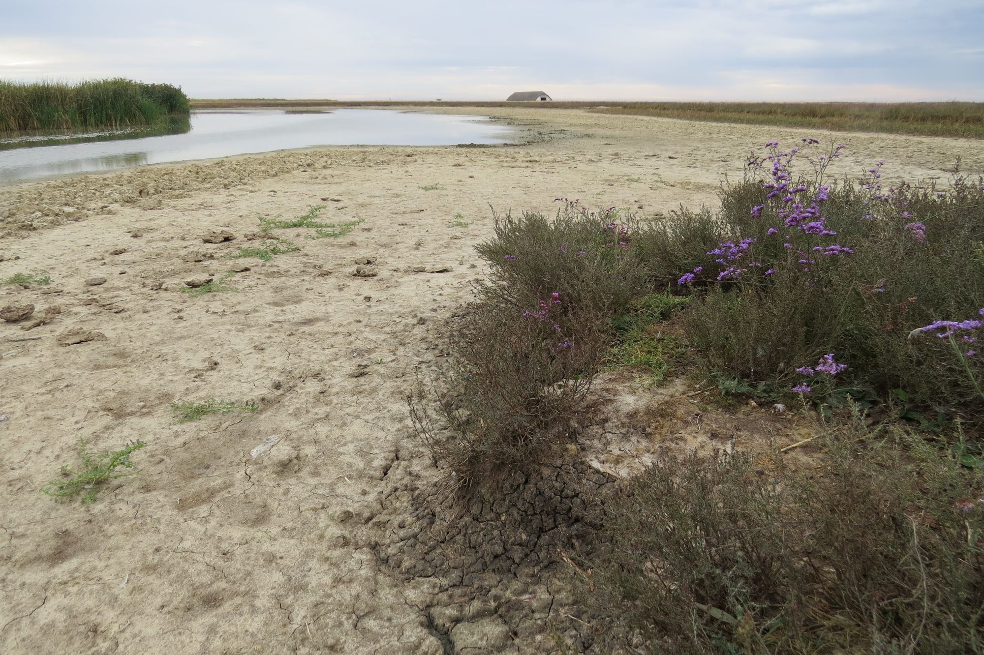
In later ages the unwooded state of the deserted pusztas is described by the reports of travellers in the Hortobágy in the XVIIIth century. This era was recognised as unwooded by the former ideas as well but the unwoodedness was explained by the effects of the Turkish wars. However it is interesting that the number of evidences concerning the presence of extensive alkaline areas besides the unwoodedness that are dated before the water regulation programme is considerable. For example Towson, an English traveller reported on the large numbers of Collared Pratincoles in the unwooded puszta - some of them he shot - on his way from Tiszafüred to Debrecen in the XVIIIth century. Pál Kitaibel - a famous Hungarian botanist - wrote about the presence of extensive alkaline areas alongside the same post-way of Debrecen on his way to the Máramaros mountains. He emphasized the strikingly marked alkaline character of this landscape compared to that of the Hevesi-sík region on the right side of the Tisza. Some species, like the cress (Lepidium crassifolium), and the sedge got extinct since that time from the Hortobágy presumably because of the water regulations, while some other species became very rare. One can find these traditionally alkaline areas in the old military maps. It is remarkable that the present shapes of marshes are practically identical to those of before the water regulation programme. It means that these areas served only as temporary floodland areas, so the alkaline patches on their shoreline could have been as extensive as centuries ago. The present horizontal sizes of alkaline benches and waterways near marshes indicate that larger microforms forming in typically alkaline soil conditions and present in eroding infusional loess banks can be thousands of years old.
Now arriving in the modern times we can ask the classical question again about the originality of the unwoodedness and the alkalization.
The sediment and pollen analysis of borings clearly indicate four things:
- The marshes of the Hortobágy were formed by the Sajó or the Hernád and not by the Tisza. The majority of the sediment came from the Bükk mountains and further from the north and not carried by the Tisza. The appearance of the Tisza did not cause any considerable change in the area, so the Hortobágy is not related to the Borsodi-Mezőség region formed by the Tisza in this respect. There was no lateral erosion of the Tisza as was believed in the past. The shifting to another river-bed was a fast process. This river did not sidle across the area and did not fill it up significantly. Its present course was occupied about 20 thousand years ago or earlier and not in the Holocene Period. According to measurements it is in the same bed for at least 16 thousand years near Polgár.
- The forests did not close in the area in the past 30 thousand years except for the immediate vicinity of the rivers.
- The alkalization process was present in different degrees in the same period.
- The Hortobágy was always a more or less unwooded area alkalizing later in different degrees.
This is an extremity of an alluvial cone inclining to the south that was effected by temporary floods even later except for the highest banks since it is a low-lying area. So the Hortobágy is a really special alkaline grassland, since while the largest areas in the zone of the steppe belt close to wooded areas are occupied (or were occupied) by loess grasslands with deep watertable, the Hortobágy is characterised by surface floods, inundations and high level of watertable everywhere. Areas of surprising similarity can be found in the short-grassed steppe zone and the older parts of floodland areas in cold semideserts, e.g. in Mongolia.
The temporary floods were done away with the water regulation programmes in the modern history without increasing the size of alkaline areas - as can be read in many studies. On the contrary, the alkalization process has started to decreased as a consequence of the formation of steppe soils. Presumably the degree of another important factor, the grazing - regarding the size of human population - could have been large enough only in the XIXth and in the first part of the XXth century to effect more signficantly the landscape development than large mammals in the past.
The state of "half-floodland area" is clearly suggested by significant erosional, namely derasional processes, e.g. the forming of alkaline benches, waterways and sink-holes (smaller equivalents of the balks and ovrags of the East-European steppe zone). The Hortobágy is the largest uninterrupted occurrence of alkaline grasslands in Europe, where the mosaic-like system of the most variable types of solonetz and solonchak soils can be found on hard and half-hard infusion loess soil and floodland sediments. The abruptness of changes are not only seen in the vegetation structure, but in that of the sediment as well, e.g. the pH of the ground water changes between 7-10, or the salt content changes between 1000 and 10 000 mg/l.