
Identification
Area: 74.865 ha
The World Heritage Site officially named as the ‘Hortobágy National Park – the Puszta' is not identical with the actual area of the Hortobágy National Park. The reason is that the national park has been expanding since the World Heritage designation, but the WHS only comprises the original area.
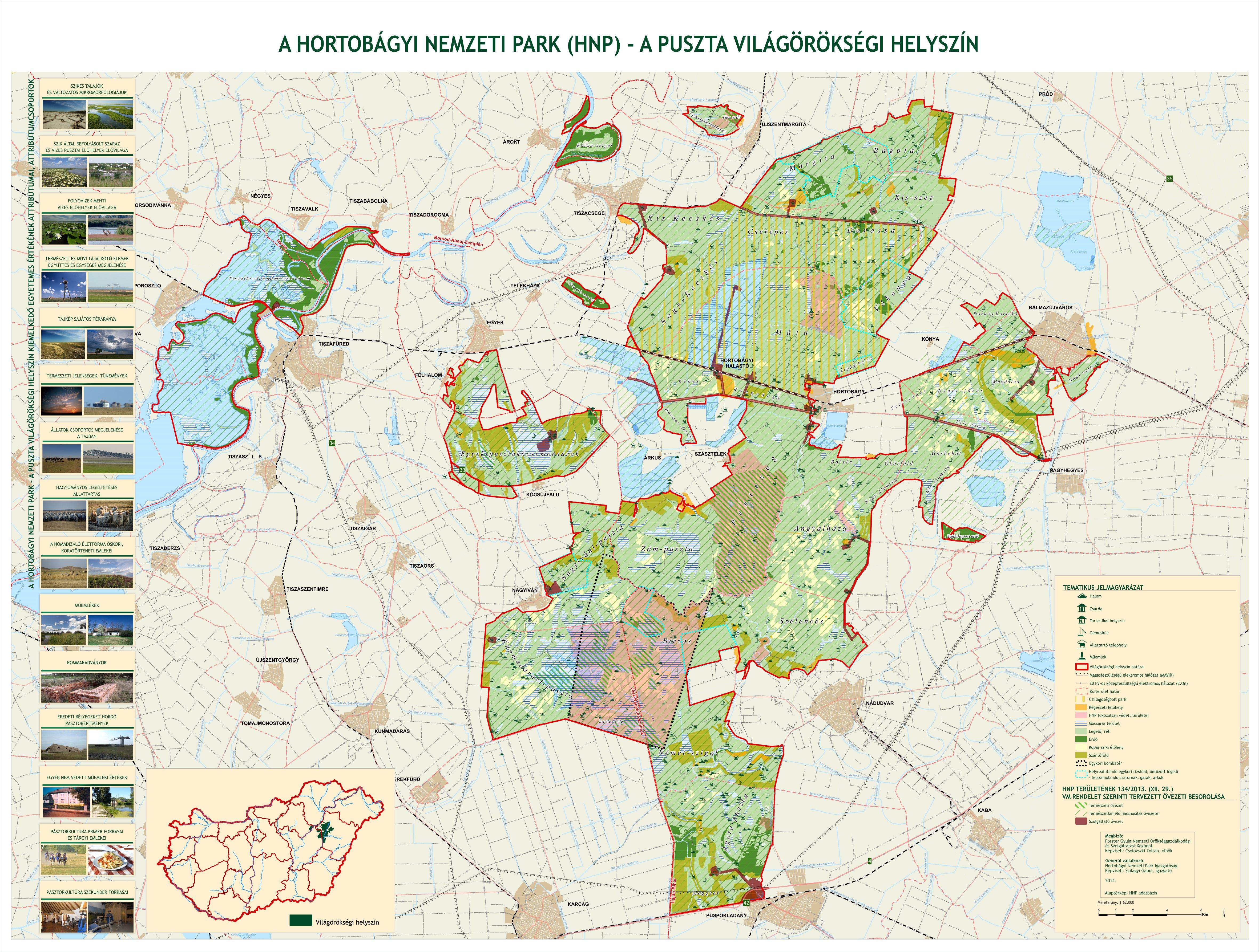
The map of the World Heritage Site
|
The boundaries of the World Heritage Site – summary table |
||
|
UNESCO World Heritage Convention – State Party |
Hungary |
|
|
The WHS name in Hungarian |
Hortobágyi Nemzeti Park – a Puszta |
|
|
The WHS name in English |
Hortobágy National Park – the Puszta |
|
|
The WHS boundaries – Geographical coordinates to the nearest second |
||
|
Centre point, latitude (WGS) |
47°33’31,20” |
N/S |
|
Centre point, longitude (WGS) |
21°03’20,20” |
E/W |
|
North eastern corner point, latitude (WGS) |
47°44’38,15” |
N/S |
|
North eastern corner point, longitude (WGS) |
21°23’04,05” |
E/W |
|
South western corner point, latitude (WGS) |
47°19’23,00” |
N/S |
|
South western corner point, longitude (WGS) |
20°37’25,89” |
E/W |
Year of designation: 1999
UNESCO property number: 474rev
World Heritage category: cultural as of criteria iv, v (cultural landscape)
Criterion (iv): The Hungarian Puszta is an exceptional surviving example of a cultural landscape constituted by a pastoral society.
Criterion (v): The landscape of the Hortobágy National Park maintains intact and visible traces of its traditional land-use forms over several thousand years, and illustrates the harmonious interaction between people and nature.